BAM – Bam Archaeological Mission – is an Iranian-French collaborative project that studies the Prehistory and Protohistory of the Bam-Narmashir region, Kerman Province, southeastern Iran. It is supported in Iran by the Research Institute of Cultural Heritage and Tourism, the Iranian Center for Archaeological Research, and the Kerman Cultural Heritage, Handicrafts and Tourism Organization, and in France by the CNRS – UMR 7041 ArScAn – Archéologie et Sciences de l’Antiquité – Archéologie de l’Asie centrale, the Ministry for Europe and Foreign Affairs, and the Institut Français de Recherche en Iran in Tehran.
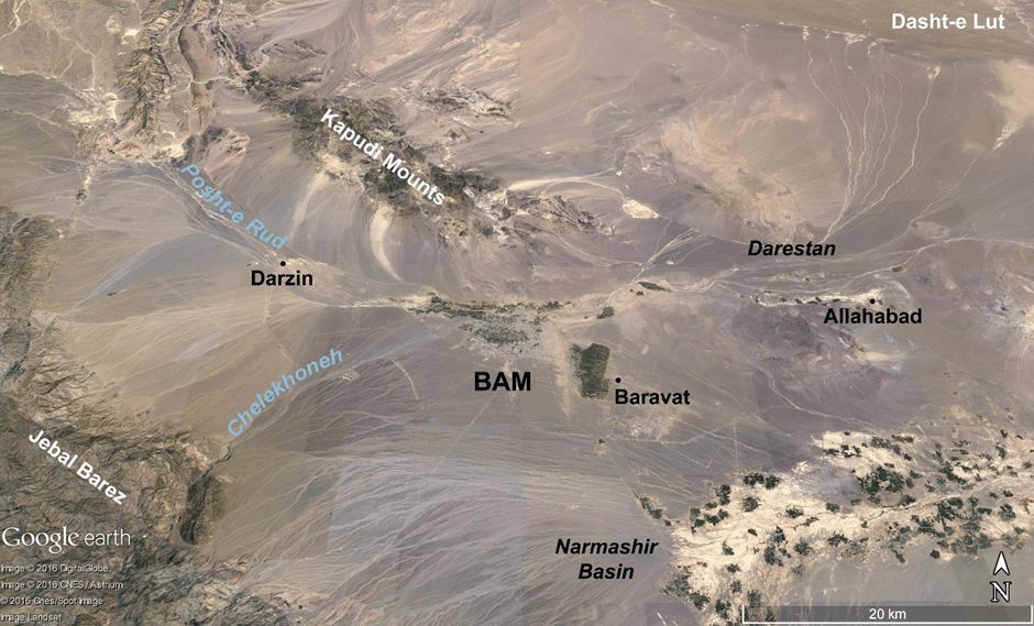
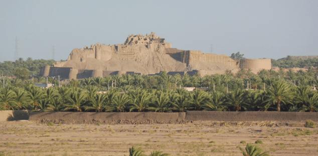
The Bam-Narmashir region is located within the southern margins of the Lut Desert, east of the Jebal Barez. Although this region is today part of one of the world’s hottest areas, paleoclimatic reconstructions have shown that climate in southeastern Iran, as in other regions of the Middle East, was more humid in the past. It then became more arid, especially from the late third millennium BCE on. Since the first millennium BCE, permanent settlement and agriculture in the Bam-Narmashir region have been supported by the underground irrigation system known as qanat. The earliest qanats in Bam are believed to date to the Achaemenid period, a period observed at several sites in the region, including at the location of the Arg-e Bam, Bam’s medieval citadel and city. Bam later became a major stop along the trade routes between the seventh and eleventh centuries CE, and the Arg-e Bam remains today famous for being among the world’s largest chineh constructions.
BAM was created in 2015. The creation of this field research project was encouraged by the late Dr. C. Adle. Adle is the one who, in the aftermath of the deadly earthquake that struck Bam on December 26, 2003, developed a new project that aimed at assessing the cultural heritage of the city and its surroundings, and the destructions that this earthquake caused to this heritage. As part of that project, Adle and his colleagues, including Dr. O. Garazhian as well as Dr. M. Atayi, L. Fazel, M. Judaki, Dr. N.A. Soleimani, and Dr. Sh. Zare, conducted archaeological surveys and excavations in the Bam-Narmashir region. In 2004, the cultural heritage of that region, “Bam and its Cultural Landscape”, was nominated to the UNESCO World Heritage List (https://whc.unesco.org/en/list/1208). Archaeological fieldwork currently continues with a focus on the early historical and Islamic periods as part of a protection and conservation program.

BAM focuses on the region’s settlement before the Achaemenid period, essentially between the Neolithic and Bronze Age periods. It aims at characterizing the regional settlement during these periods and its relationships to the archaeological cultures that have been defined in southeastern Iran and within the broader context of Middle Asia. An important aspect of this field research project is to understand where this regional settlement was distributed and how it evolved within the context of an increasing aridity, before qanats were dug and provided access to water in this region. This fieldwork currently includes two main aspects: regional surface survey and excavation at the Neolithic site of Tell-e Atashi.